Thursday January 16, 2025
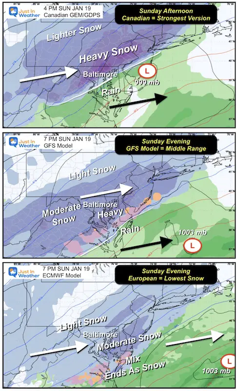
We are 3 days away from our nest snow event, so it’s time to make an initial call. This is what jokes are made of. I will show the BIG THREE global models that I have used primarily to explore the potential of storms. Among them, there are a wide range of solutions and the snow range is between 2 and 10 inches. This doesn’t cover everyone, but it helps me make my point.
In this report, we will focus on the two extremes as they help to show why there is such a difference. I will also show the snow potential of all three models AND my first call for snowfall.
This will be a Sunday event and I anticipate some impact during the afternoon and evening.
Remarks :
- The snow we received today and recent events have shown me that there may be more energy in the atmosphere than the models identify.
- I have often demonstrated loud and clear that the European ECMWF model is KING! It has been the most reliable all winter and most years.
- We are in a predominantly polar pattern. Since winter 2014, I have noticed that the Canadian model (GEM now GDPS) works very well. The country of origin is based in the source region of the extremely cold air, which may give it an advantage.
- That said, the Canadian is the model pushing the strongest storm with the most snow and a limit of rain in Maryland. I have my reservations about going for the best snow right now. The European model is in reality the weakest and furthest away.
- One more thing: weather events tend to happen earlier than initially thought. I will therefore monitor the alignment of all forces as well as the change of arrival. For now, I think Sunday afternoon is a good benchmark.
Take a look:
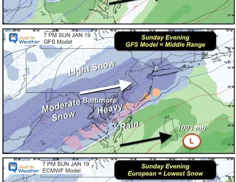
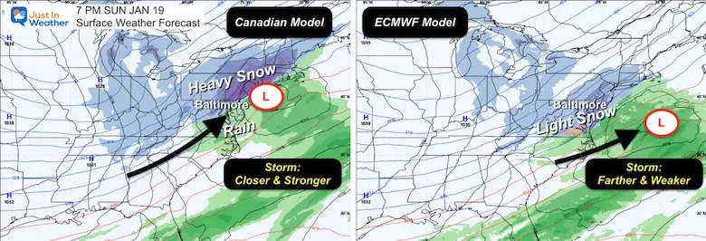
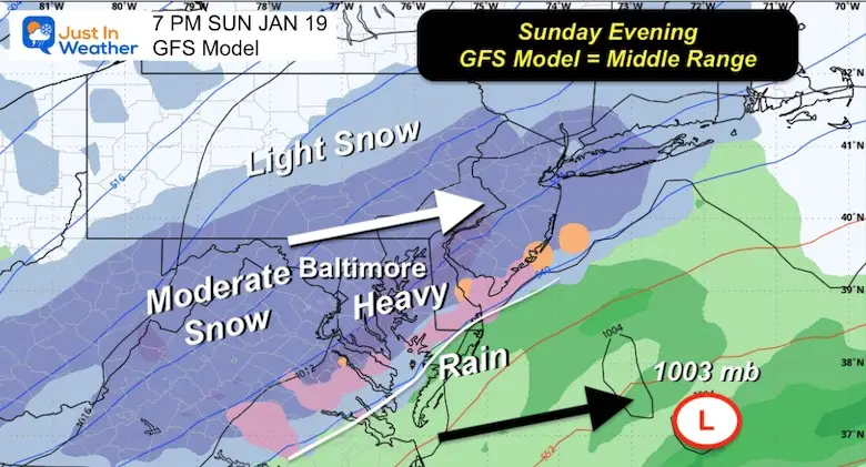
The Canadian model shows heavy snowfall at 4 p.m. The American GFS is the mid-range solution, with moderate snow in the evening at 7 p.m. The European model is also at 7 p.m., with a quick burst of moderate snow… in the same areas as the Canadian with rain.
What is happening and why
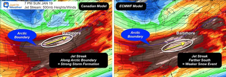
To see this we need to look at the Jet Stream. Here’s a look at the winds and spin at 500 MB, or about 18,000 feet above ground.
Heights and winds
The 500 MB height will change with temperature, which is plotted here.
Jet Streak: 100 knots + fast pocket wide within the general flow. I marked this with a white circle. This energy will promote the development of a storm at cloud level.
Canadian model: The jet crisscrosses the arbitrary Arctic boundary. This aligns with low pressure at the surface to inject more energy for rapid development and moderate to heavy precipitation into the cold air.
European ECMWF Model: The jet stream is further south…far from this Arctic border. This splits the energy and pushes the low surface further east and farther away, making the system weaker.
Vortcity
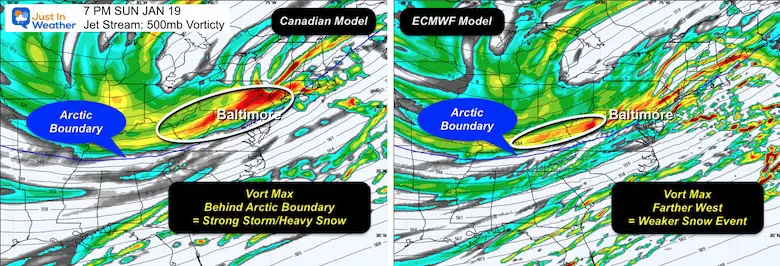
This is the rotation at the level of the jet stream.
The Canadian model has the Vort Max (circled) in the same region as the Jet Streak.
The ECMWF model has a less pronounced spin. If there is a Vort Max to identify, it is smaller and extends behind the Surface Low and the ket streak. Basically the energy is NOT aligned, which is why it produces a weaker weather event further off the coast.
Surface dieback ground
7 p.m. Sunday
The Canadian at this time the Low will pass through our area, but enveloping snow will persist in the snowy area. It also rains in southern Maryland/Delmarva.
The European model like the lower surface much further with less energy.
This draws colder air towards the coast, hence all the snow. But only a small region with a brief moderate explosion.
GFS splits the difference
This plot is mid-range and produces a decent snow event.
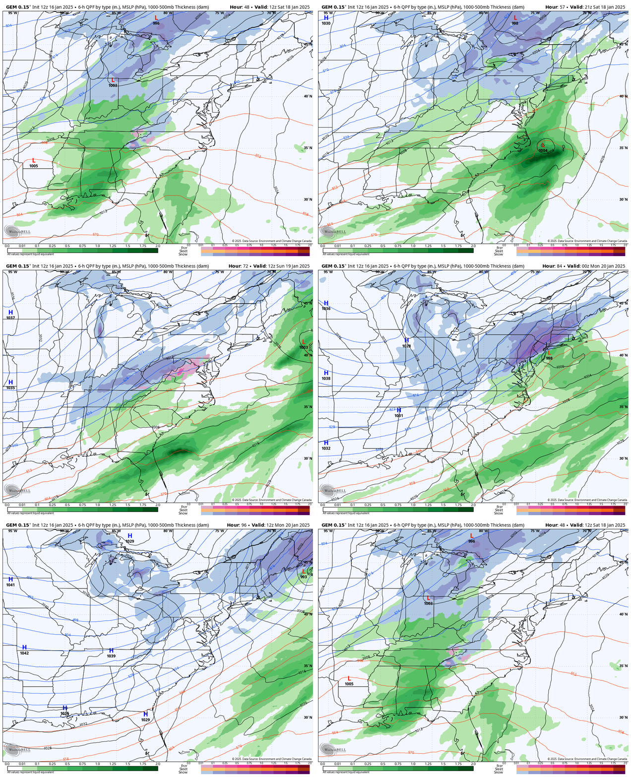
Just for fun, let’s look at the storm animations.
Canadian model:
7:00 a.m. Saturday to 7:00 a.m. Monday
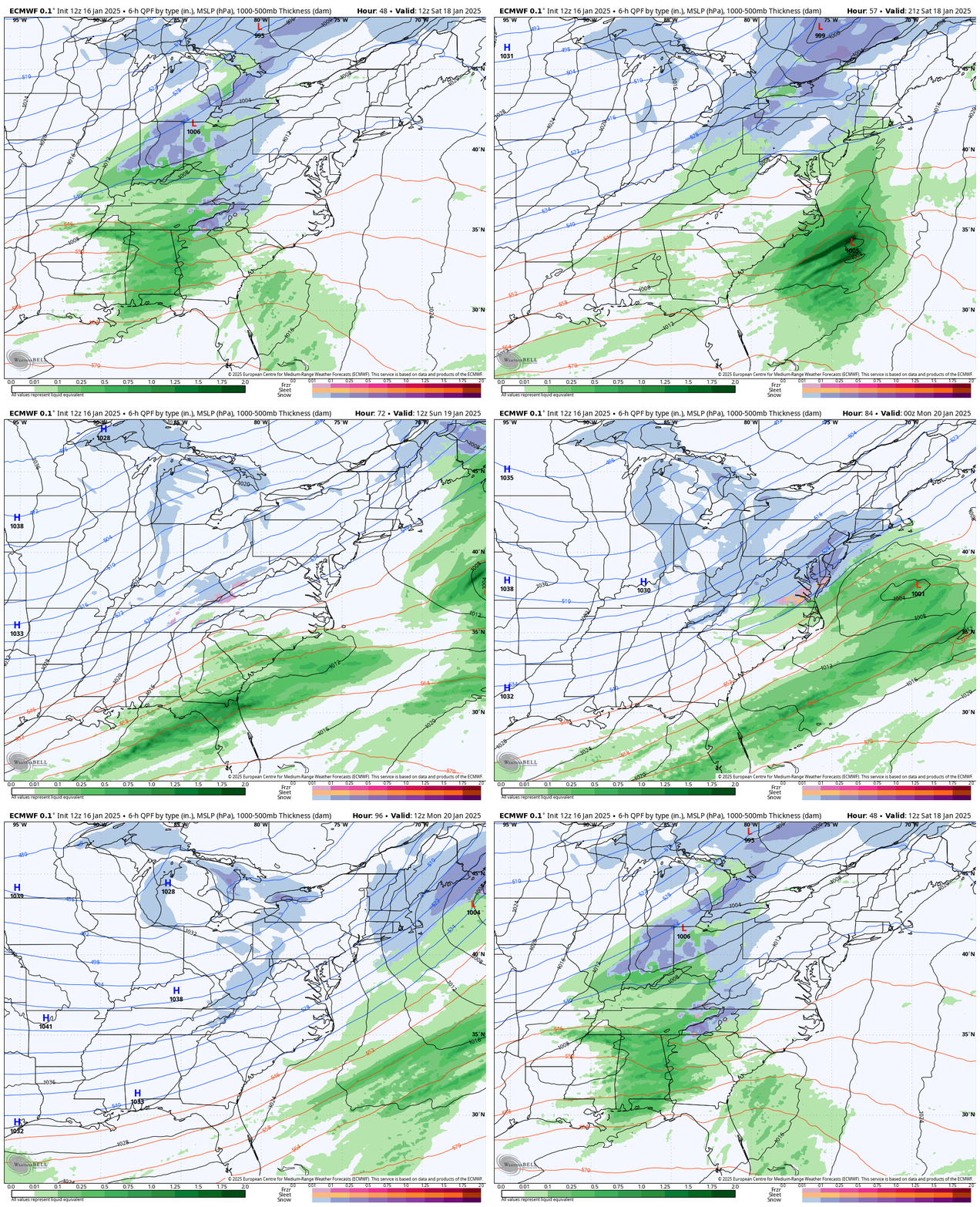
European model
7:00 a.m. Saturday to 7:00 a.m. Monday
Snow potential
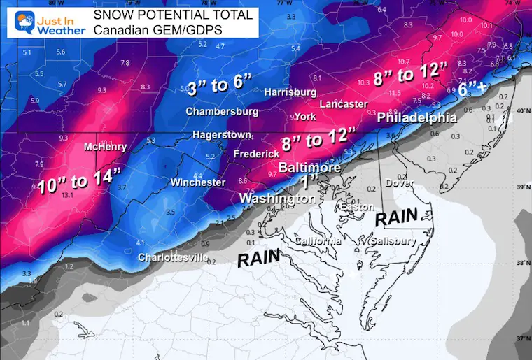
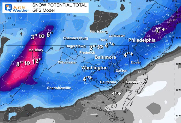
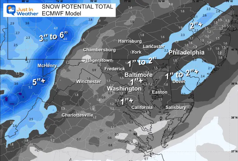
This is each model call based on a 10 to 1 ratio.
canadian
This is the one that shows the most snow, but I can’t jump on it yet.
GFS model
This is the middle of the road for a change…. It presents moderate and widespread snow.
ECMWF Model
This is the weak solution and the lowest amount of snow.
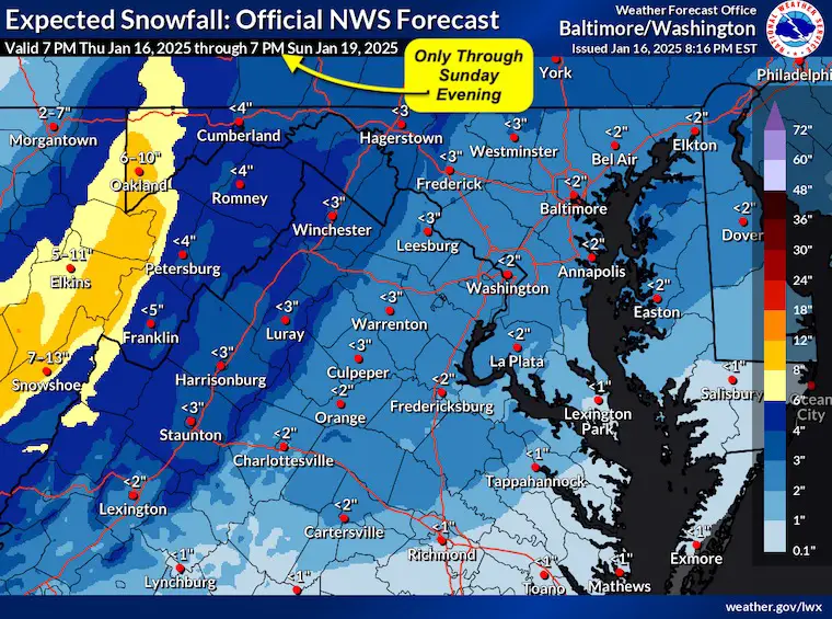
National Weather Service
If you consult the site to have their forecasts in your application, note that this map produced Thursday evening does not appear until Sunday evening. This is NOT THE FULL EVENT.
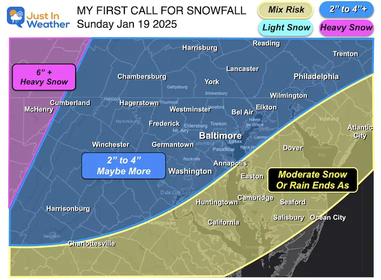
My first call for snowfall
I have little confidence in this and will do a quick update with the next round of data.
Right now, I think it’s best to suggest 2 to 4 inches of snow for most of the area. There is great “potential” for upside.
Southern Maryland and Delmarva should consider that in the event of a stronger storm, warm air could mix with rain for part of the event.
The high mountains get just about a few inches of snow if you sneeze these days. I feel safe suggesting they get more heavy snow.
Next up: my morning weather post around 6:30 a.m., then another full update on this weather event midday Friday.
Faith in snowflakes
Polar Air released
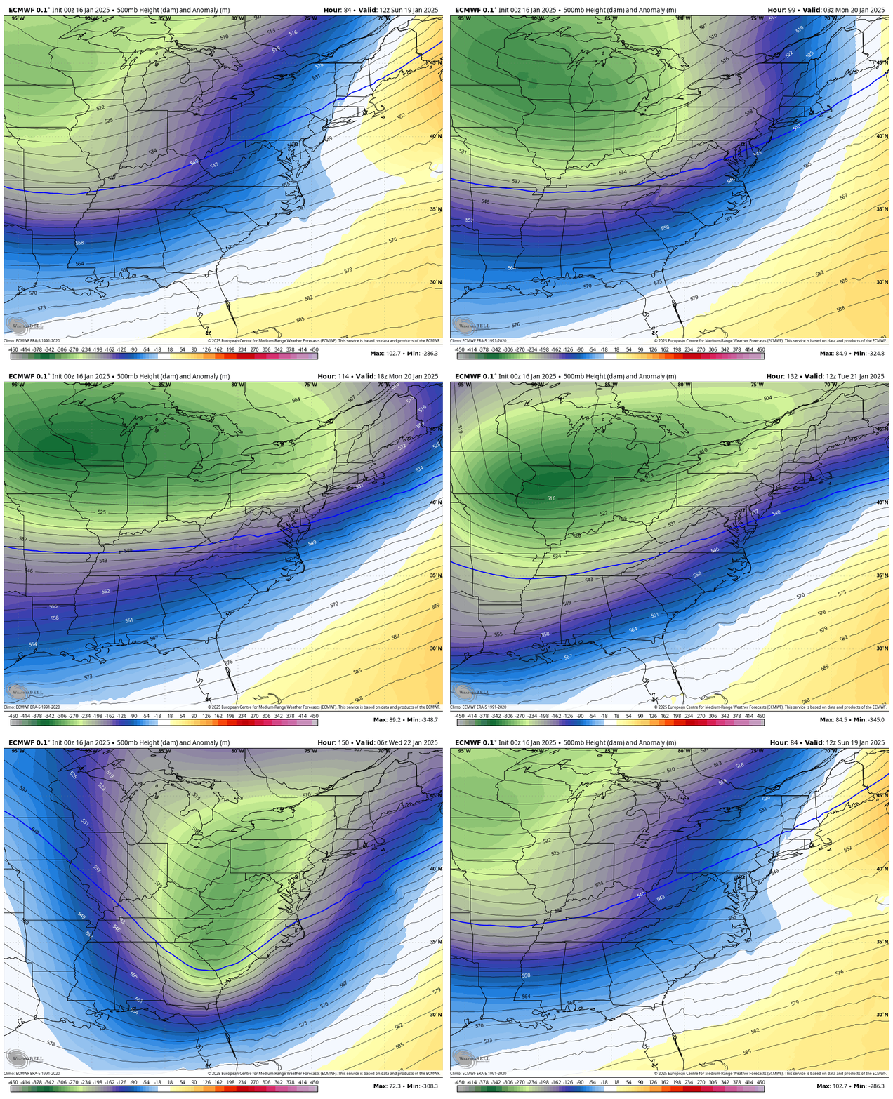
Jet Stream: Sunday to Wednesday
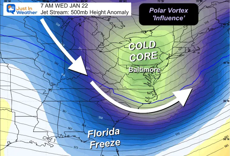
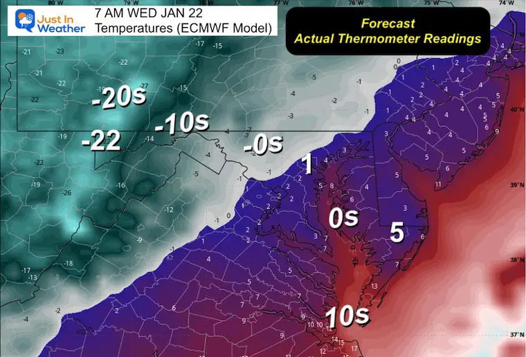
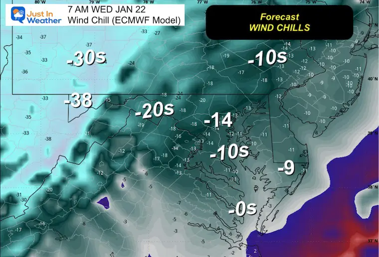
The core of cold air is expected to reach our area by Wednesday.
Wednesday morning snapshot
Wednesday morning temperatures
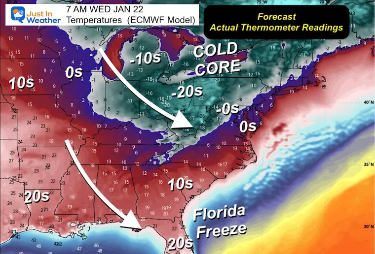
Wednesday morning temperatures (local)
These are actual numbers predicted on the thermometer.
Wednesday Morning Wind Chills (Local)
Subscribe to email alerts
Weather publications straight to your inbox
Sign up and be the first to know!
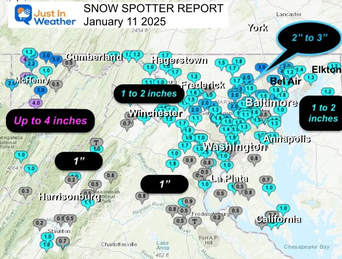
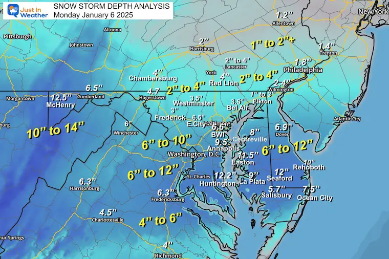
SNOW REPORTS THIS SEASON
Click on the maps for this full report.
Snow report for January 11
Snow report for January 6
Previous snow
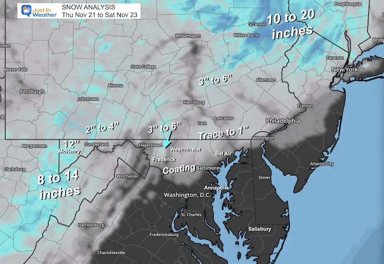
Snow report for November 22
SEE ALSO
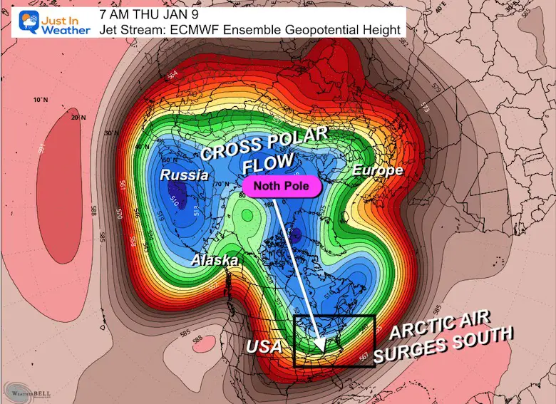
Arctic outbreak for January
If you missed it, here’s my detailed report from December 30th on why this IS A BIG DEAL!
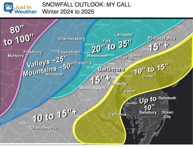
MY WINTER OUTLOOK
My Winter Outlook Report
FITF equipment for sale

In case you missed this
The origin story of Faith In The Flakes from December 5
Share your thoughts and your best weather photos/videos, or simply stay in touch via social media.
PLAN A ROD ASSEMBLY BASED ON WEATHER
Severe Weather: Smart Storm in October and next spring FITF (Faith in the Flakes) Winter Weather: November through March Click to learn more and submit a request for your school.

THANK YOU:
Baltimore Magazine Readers’ Choice Best of Baltimore
Maryland Trek 11 Day 7 completed Saturday, August 10
We’ve raised OVER $104,000 for Just In Power Kids – AND we’re still raising more.
The annual event: Hike and bike 329 miles in 7 days from The Summit of Wisp to Ocean City.
Every day, we honor a child and their family’s journey through cancer.
The fundraiser is for Just In Power Kids: funding free holistic programs. I have never taken and will never take a cent. It is up to our non-profit organization to operate.
Click here or on the image to make a donation:

REPRESENT MY MESSAGE ON DYSLEXIA
I am aware that there are some spelling and grammatical errors and other occasional issues. I take responsibility for my mistakes and even computer problems that I might miss. I’ve made a few public statements over the years, but if you’re new here you may have missed it: I have dyslexia and discovered it during my sophomore year at Cornell University. That didn’t stop me from getting my degree in Meteorology and being the first to earn the AMS CBM in the Baltimore/Washington area. One of my teachers told me that I had come this far without knowing it and that I should not let this be a crutch for the future. It was Mark Wysocki, and he was absolutely right! I miss my mistakes in my own proofreading. The autocorrect spell check on my computer sometimes does an injustice and makes the situation worse. I can also make mistakes in the forecasts. No one is perfect at predicting the future. All maps and information are accurate. “Wordy” stuff can get sticky. No editor can check my work while writing and ready to send in a newsworthy schedule. Barbara Werner is a member of the web team who helps me maintain this site. She has taken it upon herself to edit typos when available. This could be AFTER reading this. I accept this and perhaps prove that what you read really comes from me… It’s part of my charm. #FITF

