ARLINGTON, Va. (7News) — 2025 started off with the most snow D.C. has seen in three years. Reagan National received 7.2″ of snow Monday. Both BWI and Dulles airports had record snowfalls for the day. BWI picked up 6.6″ and Dulles measured 5.1″.
ALSO READ | 10 tips for driving safely in the winter
The First Alert Weather team is on your side looking ahead to the next weather maker that is set to bring a chance for measurable snow on Saturday.
DOWNLOAD THE FIRST ALERT WEATHER APP
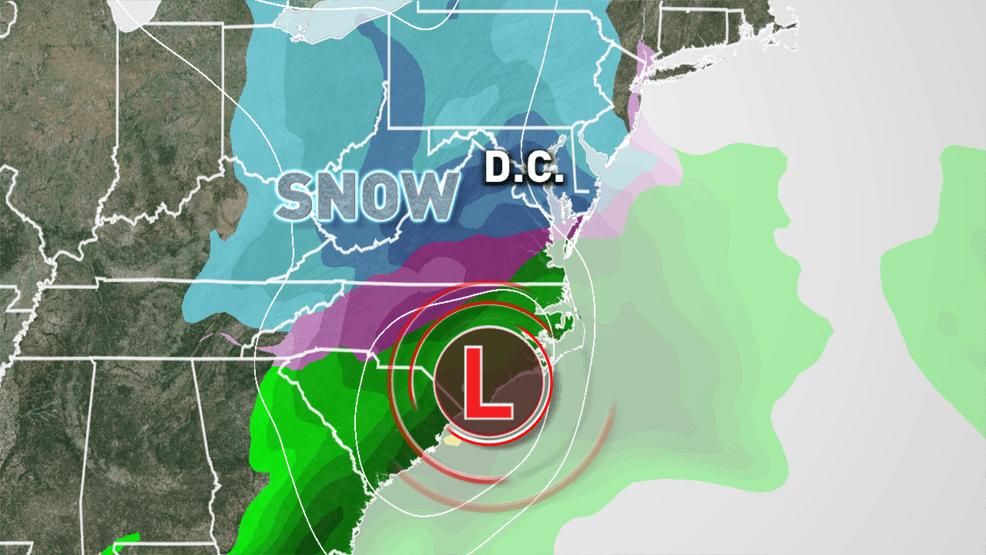
Current forecast trends show around 1-3″ areawide of measureable snow.
Trends are favoring more accumulating snow on Saturday and here is an early look at what you can expect.
As for timing, the current thinking is snow could start after 11 p.m. Friday.
When the snow ends on Saturday afternoon, we should see some melting with temperatures rising into the mid to upper 30s.
We’ll monitor the trends, as new data comes in. We are confident the colder-than-average weather pattern will continue through the middle of the month, so keep the warm weather gear at the ready!
READ THE LATEST FIRST ALERT WEATHER FORECAST HERE
Download the First Alert Weather app to stay up to date with the latest forecast.


